Pasadena wildfire risk mitigation, home hardening, and assessment
RF1 helps Pasadena homeowners understand local wildfire exposure, prioritize defensible space and home-hardening work, and document mitigation clearly for insurance conversations.
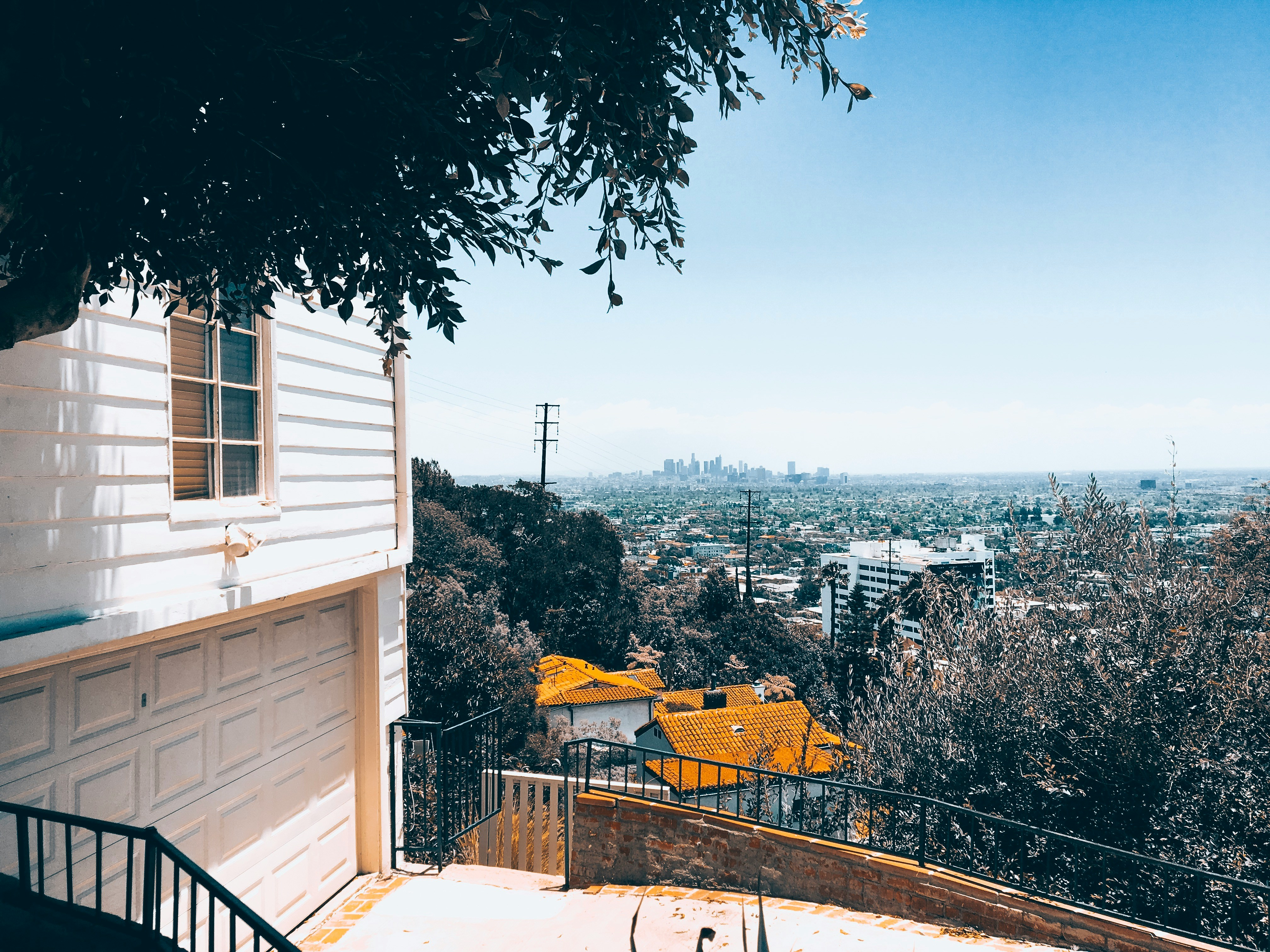
Older hillside homes often combine mature trees, vents, roof edges, and dense side yards.
Start with the risks you can actually fix
Vents firstClose ember entry points before yard work gets expensive.
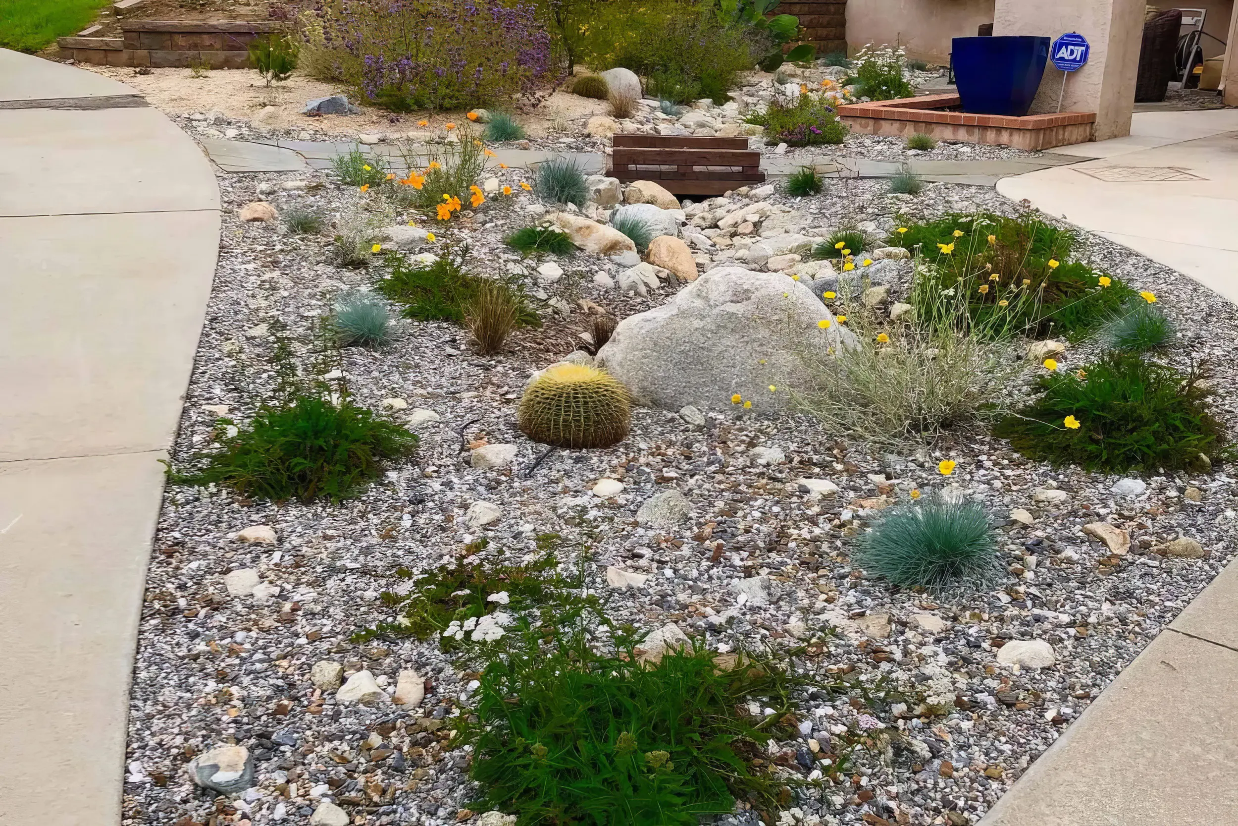
Zone 0 nextClean the first 5 feet and break fuel paths to the house.
Proof mattersLeave with photos and a short, ranked mitigation plan.
Local risk context
The map tells you the neighborhood. RF1 tells you what to fix at the house.
Pasadena's risk changes by neighborhood. Denser urban blocks need ember and structure-to-structure planning, while hillside and canyon-adjacent homes need defensible space, roof-edge cleanup, and vegetation separation.
The useful answer is not “am I in a fire zone?” It is “what should I fix first?”
Start with the mapped exposure. RF1 uses the local hazard context to understand slope, canyon wind, and nearby vegetation pressure.
Then inspect the ember paths. Vents, roof edges, decks, fences, attachments, plants, and debris decide how that exposure reaches the home.
Leave with a short fix order. The assessment turns the map into a ranked plan for vents first, Zone 0 next, and documentation for insurance conversations.
CAL FIRE risk context near Pasadena
Pan and click mapped zones to compare nearby hazard classifications.
Local fire history
Fires that shaped wildfire risk in Pasadena
Pasadena designates its foothill neighborhoods — including areas around upper Hastings Ranch, the Arroyo, and the streets closest to the San Gabriel front — as Very High Fire Hazard Severity Zones, and CAL FIRE's 2025 map update pushed those boundaries further into the city. Risk in Pasadena genuinely changes block by block, which is why a parcel-level review matters more than the citywide label.
2025
Eaton Fire
Burned into northeast Pasadena neighborhoods and forced evacuation orders for tens of thousands of residents, with ember and smoke damage reaching well beyond the burn perimeter.
2009
Station Fire
Burned the Angeles National Forest above the Pasadena foothills for weeks, the largest fire in Los Angeles County history.
Local vegetation and Zone 0
The plants are not the whole problem. The path to the house is.

Pasadena's risk changes block by block: Arroyo Seco edges, hillside streets, mature canopy, and dense historic neighborhoods all need a different mitigation order.
In Pasadena, RF1 looks for the ways vegetation, fences, roof edges, gutters, and neighboring lots connect. The goal is not to strip the yard. It is to break the ember path before it reaches vents, siding, windows, decks, and the first 5 feet around the structure.
Local signals RF1 checks first
First move
Start with ember entry points like vents and roof edges, then clean up Zone 0 around the yard.
Book a Free Wildfire Risk Assessment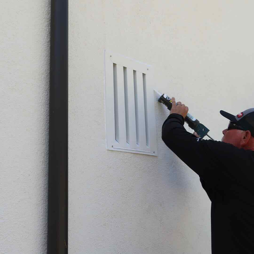
1. Protect openings
Vents, eaves, attic entries, and roof edges are where ember defense starts.
2. Clear the ember path
Then clean up the first 5 feet: mulch, dry leaves, stored items, fences, and plants touching the home.
3. Make it usable
Leave with a short priority list, not a pile of advice.
RF1 separates what to do now, what can wait, and what should be photographed for insurance conversations.
Home-specific plan
The right plan depends on the home, the slope, and the access
Pasadena includes older craftsman and Spanish-style homes, multifamily pockets, hillside estates, and denser streets with narrow side yards. The closer the homes, the more important vents, windows, fences, and attachments become.
RF1 adjusts the order of work to the house: vents and ember entry points first, then the vegetation and attachments that feed them.
What your RF1 assessment answers
01
Where can embers get in?
Vents, roof edges, eaves, gaps, decks, and attachments.
02
What is feeding that exposure?
Mulch, dry leaves, hedges, fences, sheds, and nearby canopy.
03
What should be fixed first?
A ranked plan with photos, materials, and insurance-ready notes.
Official resources
Official guidance, translated into a real plan
Use these resources for official fire department, city, county, and CAL FIRE guidance. RF1 can help translate the requirements into a practical property checklist and documented mitigation plan.
Homeowner questions
Common Pasadena wildfire mitigation questions
Which parts of Pasadena are in a Very High Fire Hazard Severity Zone?
The highest designations cluster in the foothill and Arroyo-adjacent neighborhoods in the northern part of the city, but the 2025 CAL FIRE map update expanded zone boundaries, so the only reliable answer is checking your specific parcel. RF1 reviews the current hazard designation for your address as part of every assessment.
My Pasadena home was not in the Eaton Fire footprint. Why did my insurer still flag it?
Carriers rate exposure by hazard zone, wind patterns, and proximity to wildland fuel, not just past burn footprints. After the Eaton Fire, many underwriters tightened their view of the entire San Gabriel foothill corridor. Documented mitigation — photos, materials, and a clear scope of completed work — is one of the few levers homeowners control.
Do I need a wildfire risk assessment in Pasadena?
Pasadena homes can have very different exposure depending on slope, vegetation, rooflines, vents, neighboring parcels, and Zone 0 conditions. A parcel-level assessment helps prioritize the work that matters first.
What does RF1 check during a Pasadena assessment?
RF1 checks Zone 0, roof edges, gutters, vents, eaves, decks, fences, vegetation, access, and documentation needs. The goal is a prioritized mitigation plan, not a generic checklist.
Can wildfire mitigation help with insurance documentation?
Mitigation work can support insurance conversations when it is clearly documented. RF1 helps organize photos, scope, materials, and next steps so homeowners can share a concise package with their agent or carrier.
Wildfire risk assessments near Pasadena
Get a wildfire mitigation checklist for your Pasadena home
RF1 turns the map, vegetation, home-hardening issues, and insurance documentation into a prioritized plan you can actually use.