Sierra Madre wildfire risk mitigation, home hardening, and assessment
RF1 helps Sierra Madre homeowners understand local wildfire exposure, prioritize defensible space and home-hardening work, and document mitigation clearly for insurance conversations.
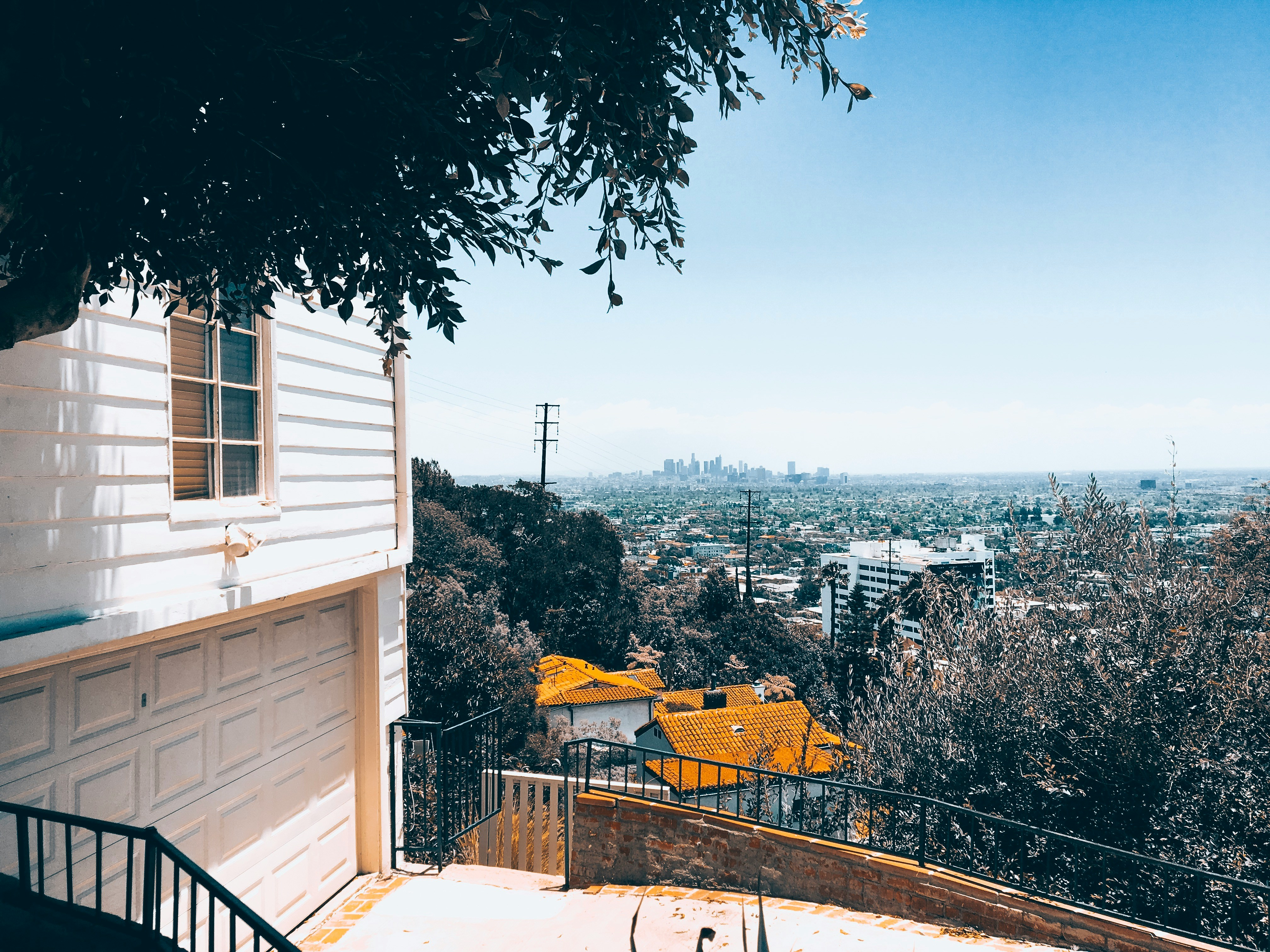
Foothill homes need a plan that accounts for older construction, trees, and neighboring parcels.
Start with the risks you can actually fix
Vents firstClose ember entry points before yard work gets expensive.
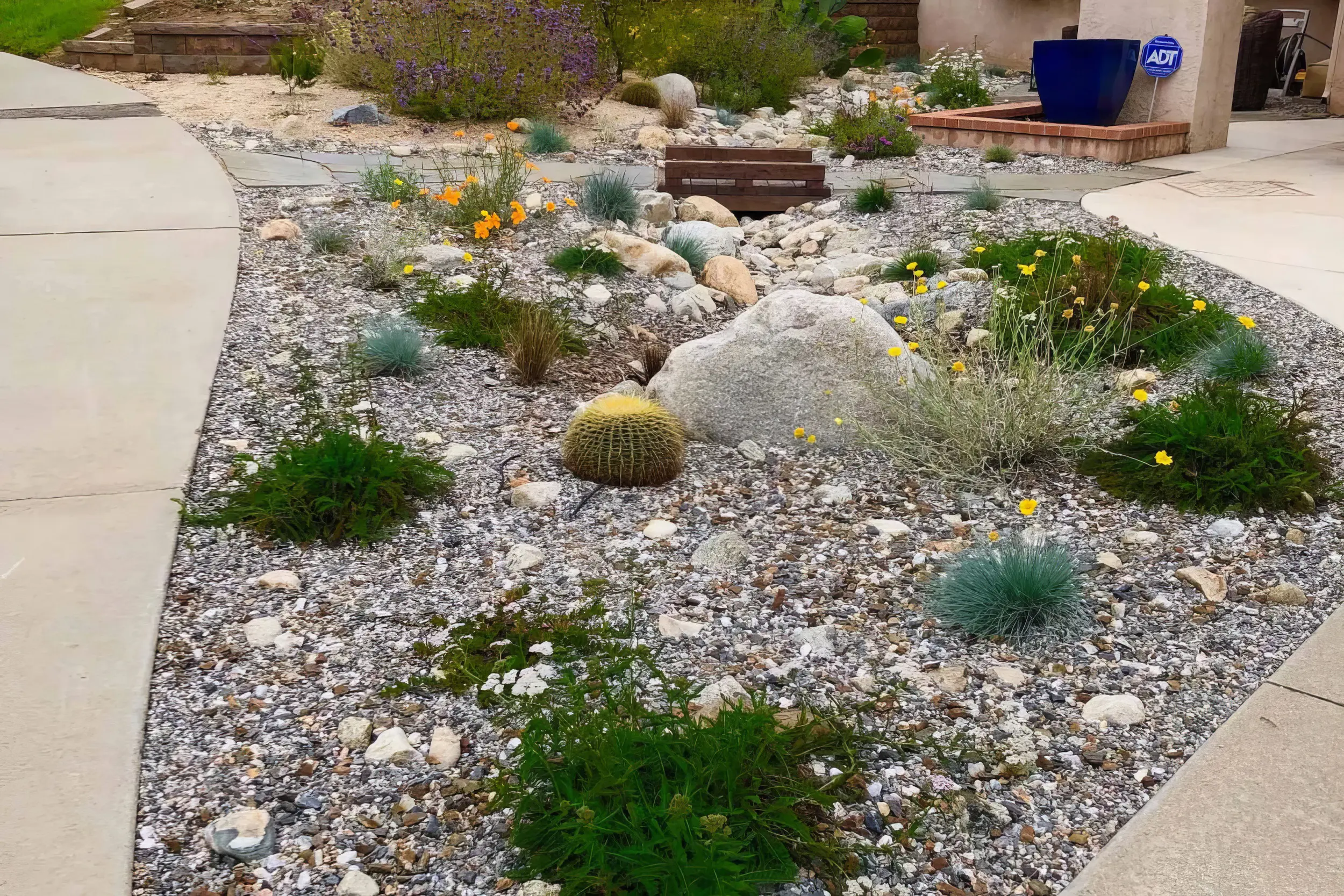
Zone 0 nextClean the first 5 feet and break fuel paths to the house.
Proof mattersLeave with photos and a short, ranked mitigation plan.
Local risk context
The map tells you the neighborhood. RF1 tells you what to fix at the house.
Sierra Madre's foothill setting creates a direct relationship between wildland vegetation, canyon winds, older homes, and neighborhood density. Mitigation should focus on ember entry, Zone 0, roof edges, and ladder-fuel reduction near homes.
The useful answer is not “am I in a fire zone?” It is “what should I fix first?”
Start with the mapped exposure. RF1 uses the local hazard context to understand slope, canyon wind, and nearby vegetation pressure.
Then inspect the ember paths. Vents, roof edges, decks, fences, attachments, plants, and debris decide how that exposure reaches the home.
Leave with a short fix order. The assessment turns the map into a ranked plan for vents first, Zone 0 next, and documentation for insurance conversations.
CAL FIRE risk context near Sierra Madre
Pan and click mapped zones to compare nearby hazard classifications.
Local fire history
Fires that shaped wildfire risk in Sierra Madre
Sierra Madre's hillside and canyon neighborhoods are mapped in Very High Fire Hazard Severity Zones, and the city has been evacuated or threatened three times since 2008. The compact lot pattern means one parcel's hedge line or roof debris affects the neighbors, so mitigation works best when it is coordinated street by street.
2025
Eaton Fire
Put Sierra Madre under evacuation orders as the fire spread east along the foothills from Eaton Canyon, coming within blocks of the town's western neighborhoods.
2020
Bobcat Fire
Forced evacuation orders for Sierra Madre's northern hillside streets as the fire burned the San Gabriel front above town.
2008
Santa Anita Fire
Burned roughly 500 acres in the hills directly above town and forced evacuations, a reminder of how little buffer exists between the wildland edge and Sierra Madre's compact streets.
Local vegetation and Zone 0
The plants are not the whole problem. The path to the house is.

Sierra Madre sits directly below Angeles National Forest access points, where upper streets, canyon wind, mature trees, and compact lots can connect ember exposure from one parcel to the next.
In Sierra Madre, RF1 looks for the ways vegetation, fences, roof edges, gutters, and neighboring lots connect. The goal is not to strip the yard. It is to break the ember path before it reaches vents, siding, windows, decks, and the first 5 feet around the structure.
Local signals RF1 checks first
First move
Start with ember entry points like vents and roof edges, then clean up Zone 0 around the yard.
Book a Free Wildfire Risk Assessment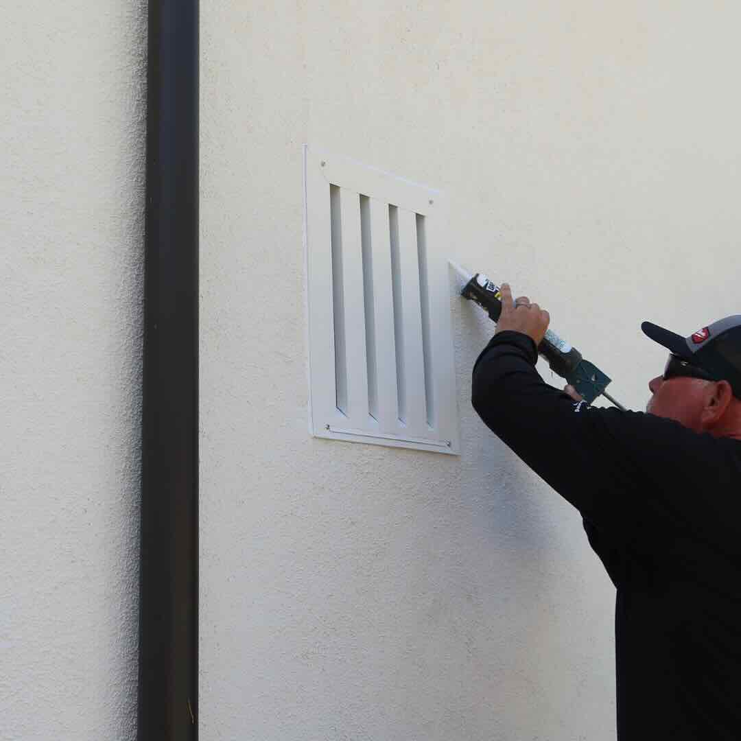
1. Protect openings
Vents, eaves, attic entries, and roof edges are where ember defense starts.
2. Clear the ember path
Then clean up the first 5 feet: mulch, dry leaves, stored items, fences, and plants touching the home.
3. Make it usable
Leave with a short priority list, not a pile of advice.
RF1 separates what to do now, what can wait, and what should be photographed for insurance conversations.
Home-specific plan
The right plan depends on the home, the slope, and the access
Sierra Madre has many older homes, tree-lined streets, hillside lots, and compact foothill neighborhoods. The density means one parcel's fence line, hedge, or overhanging canopy can influence the next parcel's exposure.
RF1 adjusts the order of work to the house: vents and ember entry points first, then the vegetation and attachments that feed them.
What your RF1 assessment answers
01
Where can embers get in?
Vents, roof edges, eaves, gaps, decks, and attachments.
02
What is feeding that exposure?
Mulch, dry leaves, hedges, fences, sheds, and nearby canopy.
03
What should be fixed first?
A ranked plan with photos, materials, and insurance-ready notes.
Official resources
Official guidance, translated into a real plan
Use these resources for official fire department, city, county, and CAL FIRE guidance. RF1 can help translate the requirements into a practical property checklist and documented mitigation plan.
Homeowner questions
Common Sierra Madre wildfire mitigation questions
Sierra Madre has been evacuated repeatedly. What actually reduces risk for a home here?
The highest-leverage work is at the structure: ember-resistant vents, clean roof valleys and gutters, a noncombustible first 5 feet, and breaking the fuel path from hedges and fences into the house. On Sierra Madre's compact blocks, embers travel between parcels, so close-in hardening protects you even when the fire never reaches your street.
Does Sierra Madre's canyon zone have different requirements than the rest of town?
The hillside and canyon areas carry Very High Fire Hazard Severity Zone designations with defensible space obligations, and homes there face tighter access and steeper slope exposure. RF1 checks your parcel's designation and builds the plan around the specific street, slope, and access pattern.
Do I need a wildfire risk assessment in Sierra Madre?
Sierra Madre homes can have very different exposure depending on slope, vegetation, rooflines, vents, neighboring parcels, and Zone 0 conditions. A parcel-level assessment helps prioritize the work that matters first.
What does RF1 check during a Sierra Madre assessment?
RF1 checks Zone 0, roof edges, gutters, vents, eaves, decks, fences, vegetation, access, and documentation needs. The goal is a prioritized mitigation plan, not a generic checklist.
Can wildfire mitigation help with insurance documentation?
Mitigation work can support insurance conversations when it is clearly documented. RF1 helps organize photos, scope, materials, and next steps so homeowners can share a concise package with their agent or carrier.
Wildfire risk assessments near Sierra Madre
Get a wildfire mitigation checklist for your Sierra Madre home
RF1 turns the map, vegetation, home-hardening issues, and insurance documentation into a prioritized plan you can actually use.